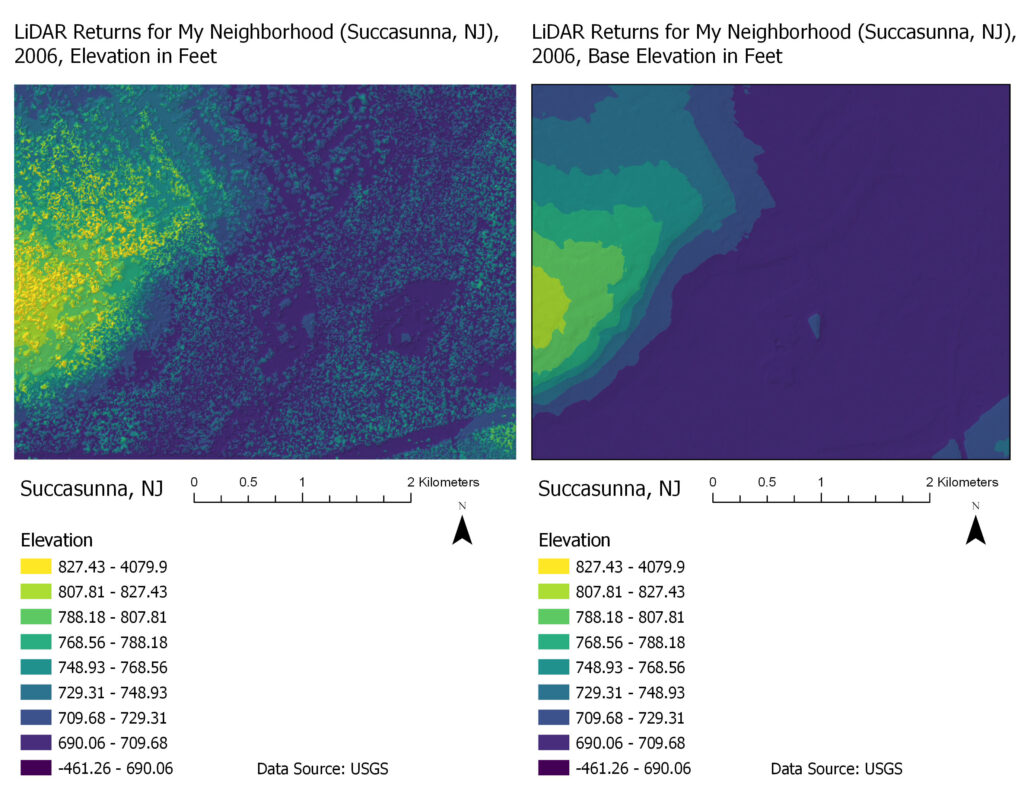
[Assignment 5] The below two maps display LiDAR data, which is very high-resolution elevation data. I chose to display the LiDAR data for part of my neighborhood in Succasunna, NJ (plus the surrounding area based on available data). The left side of these maps are primarily residential housing and the rest is woods, which can explain the differences in elevation.