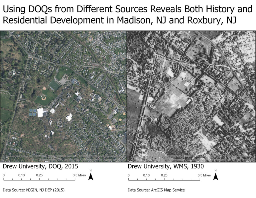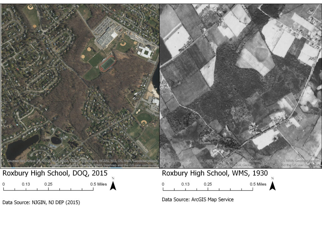
[Assignment 4] Below are 4 maps consisting of two comparative sets. The first set is of Drew University (and surrounding Madison) in 2015 and 1930. The second set is of Roxbury High School (and surrounding Roxbury) in 2015 and 1930. These maps illustrate the use of remote sensing data and aerial imagery, along with changes to landscapes over an 85 year period. A particularly interesting finding I found was that there are two small bodies of water in the bottom left section of the Roxbury High School, DOQ, 2015 image that is not in the corresponding 1930 image.