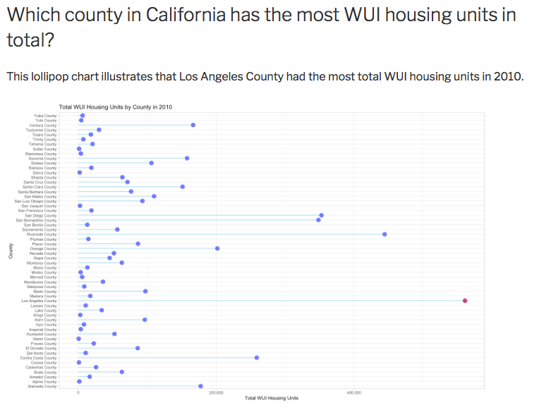
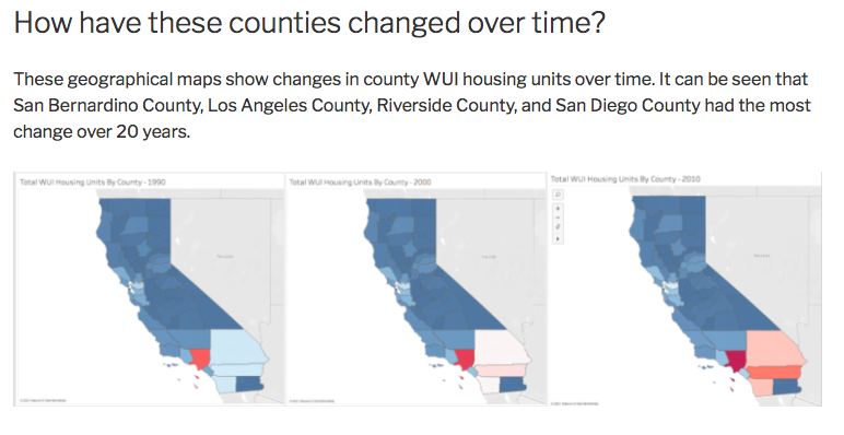
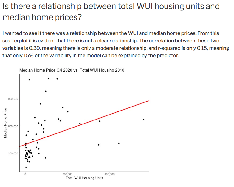
This page showcases my final project from my Data Visualization class. This project examines the wildland-urban interface (WUI), which is the area where housing meets or intermingles with undeveloped vegetation, through a series of visualizations. I’ve attached my powerpoint presentation, along with separate posts that go into more detail about each visualization.
![](https://lisastites.com/wp-content/uploads/2021/04/Screen-Shot-2021-04-20-at-1.45.11-AM.png)
![](https://lisastites.com/wp-content/uploads/2021/04/Screen-Shot-2021-04-20-at-1.44.49-AM.png)
![](https://lisastites.com/wp-content/uploads/2021/04/Screen-Shot-2021-04-20-at-1.47.05-AM.png)
![](https://lisastites.com/wp-content/uploads/2021/04/Screen-Shot-2021-04-20-at-1.49.44-AM.png)
![](https://lisastites.com/wp-content/uploads/2021/04/Screen-Shot-2021-04-20-at-1.51.02-AM.png)
![](https://lisastites.com/wp-content/uploads/2021/04/Screen-Shot-2021-04-20-at-1.53.24-AM.png)
![](https://lisastites.com/wp-content/uploads/2021/04/Screen-Shot-2021-04-20-at-1.56.28-AM.png)